> For the complete documentation index, see [llms.txt](https://docs.gainforest.earth/llms.txt). Markdown versions of documentation pages are available by appending `.md` to page URLs; this page is available as [Markdown](https://docs.gainforest.earth/gainforest.app-and-bumicerts/globe.md).

# Globe

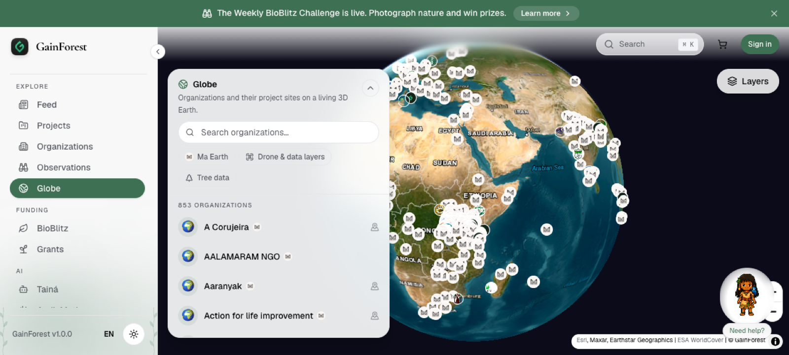
The **Globe** is a 3D map on GainForest.app for exploring organizations, Projects, and mapped environmental work around the world.

[Open Globe](https://www.gainforest.app/en/globe)

<figure><img src="/files/5SveIaAF0sW6RWxkZakA" alt="GainForest.app Globe showing organizations and mapped project sites"><figcaption><p>The Globe shows organizations and Project locations on a living 3D Earth.</p></figcaption></figure>

## What the Globe is for

The Globe helps people see where environmental work is happening, not just read about it.

It can help:

* nature stewards show where their Projects are located
* organizations make their work more visible
* supporters explore Projects by place
* funders understand the geographic context of a Project
* communities connect Project evidence to real landscapes

## What you can explore

On the Globe, users can explore:

<table data-view="cards"><thead><tr><th></th><th></th></tr></thead><tbody><tr><td><strong>Organizations</strong></td><td>Browse organizations with public profiles and mapped activity.</td></tr><tr><td><strong>Project sites</strong></td><td>View mapped Project locations or site boundaries where available.</td></tr><tr><td><strong>Land cover</strong></td><td>Turn on land cover layers based on ESA WorldCover data.</td></tr><tr><td><strong>Tree data</strong></td><td>Explore measured tree data where organizations have uploaded it.</td></tr><tr><td><strong>Drone and data layers</strong></td><td>View extra map layers, including drone or structured geospatial data where available.</td></tr><tr><td><strong>Ma Earth Projects</strong></td><td>Filter for organizations connected to Ma Earth funding rounds.</td></tr></tbody></table>

## Globe views

The Globe has different views depending on where you enter from:

* **Global view** — browse organizations and mapped activity around the world.
* **Organization view** — focus on one organization and its mapped Project sites.
* **Project view** — focus on one Project and its site boundaries, where those boundaries are available.

Project and organization pages may include a **View on Globe** link when there is mapped location information.

## Layers and filters

The Globe includes filters and layers that help users focus on different kinds of data.

Examples include:

* Ma Earth organizations
* organizations with drone or data layers
* organizations with tree data
* land cover classes such as tree cover, cropland, wetlands, mangroves, water, grassland, shrubland, and built-up areas
* measured tree points where tree data is available
* time-series drone layers where the same area was captured on different dates

## How this connects to Projects

A Project becomes easier to understand when its story, evidence, and location are connected.

The Globe helps show the spatial side of a Project: where the work is happening, which areas are mapped, and what data layers are connected to the place.

{% content-ref url="/pages/hY4MkYoYXePMJTde0cMH" %}
[What is a Project?](/gainforest.app-and-bumicerts/what-is-a-project.md)
{% endcontent-ref %}

{% content-ref url="/pages/b1KOtG9hDQJJgajdwvxQ" %}
[Linking Evidence to Projects](/for-nature-stewards/overview/linking-evidence-to-projects.md)
{% endcontent-ref %}

## If you do not see your Project on the Globe

A Project may not appear on the Globe if it does not yet have mapped location information or site boundaries.

If your organization needs to add larger geospatial data, drone imagery, tree data, or other structured map layers, use the batch upload process.

{% content-ref url="/pages/vNFpkyVWuF8xtjnCjC51" %}
[Batch Uploads](/for-nature-stewards/overview/batch-uploads.md)
{% endcontent-ref %}
